Visited: Sept 2016
Nearby city: Seattle, WA and Tacoma, WA (west side); Yakima, WA (east side)
"...the most luxuriant and the most extravagantly beautiful of all the alpine gardens I ever beheld in all my mountain-top wanderings."
-John Muir on Paradise region, 1889
At 14,411 ft, Mt. Rainier (known as "Tahoma" or "Tacoma" to the indigenous Salish peoples) is the tallest mountain in the State of Washington and the seventeenth tallest mountain in the US. What makes Mt. Rainier so special is its prominence, a measurement of how high the summit rises above its surroundings. With a prominence of 13,210 ft, Mt. Rainier is the third most prominent mountain in the US (behind only Denali in Alaska and Mauna Kea (Big Island) of Hawaii). Mt. Rainier is more prominent than K-2, the second tallest mountain in the world. Mt. Rainier absolutely dominates the horizon of the Seattle Metro area, with the peak high above the clouds its as if it hovers over the city. It's hard to believe that it's connected to the earth.

Mt. Rainier is the most glaciated peak in US outside of Alaska, with 26 major glaciers including Emmons Glacier, the largest glacier in the lower 48. Although spectacularly beautiful, Mt. Rainier is a very dangerous dormant volcano. The last major eruption was in 1894. A volcanic eruption of Rainier would be absolutely devastating to the millions of people living in Seattle metro.
Mt. Rainier National Park (created in 1899 as the fifth US National Park) essentially focuses solely on this massive, magnificent mountain. Backpackers can take the 93 mile Wonderland Trail that circles the entire peak. Experienced hikers and mountaineers can attempt to summit the mountain. This is extreme, requires lots of preparation, training, gear, time etc. (Don't think you can summit this thing in a day hike, that's impossible). Anyway, there are plenty of amazing hikes for average folks like us to soak in the incredible alpine views. Mt. Rainier is simply amazing, it's one of my favorite parks. I think you will enjoy it immensely.
We entered the Park on the far west edge along the Mather Memorial Parkway (WA highway 410) and got our first glimpse of the peak. The sunlight slowly revealing its majesty, overlooking Tipsoo Lake. It was glorious.
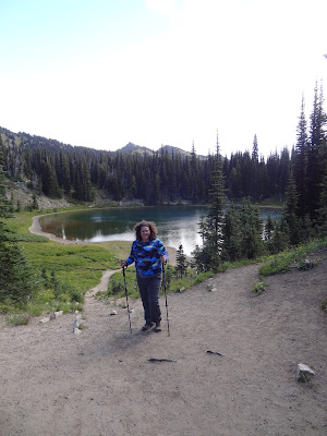
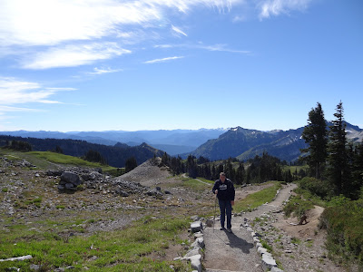
Our first stop was Sunrise Visitor Center, in the northeast section of the Park. This is the highest spot in the Park that you can reach by car and an excellent starting point for a number of trails that provide excellent views of the north face of Mt. Rainier and Emmons Glacier. We took the 4.8 mile trail (roundtrip) to Burroughs Mountain (stopping at Shadow Lake on the way there and Frozen Lake on the way back).
 |
| Shadow Lake |
 |
| Emmons Glacier |
 |
| White River |
 |
| Lord of the Rings music in my head...I feel like a Hobbit setting out on an adventure 😊 |
 |
| Emmons Glacier |
 |
| trail was a bit precarious and it's very windy |
 |
| on top of First Burroughs Mountain. If you want you can continue for another mile to get to the top of 2nd Burroughs Mountain and get closer to Mt. Rainier |
 |
| it was very windy! |
 |
| Frozen Lake |
We then headed down to the southwest corner of the Park to see the Grove of the Patriarchs. Lots of big trees to see and stroll through (it's only about a mile hike) and the Ohanapecosh Visitor Center.
We then went along Stevens Canyon Road. Here there is a multitude of turnouts to view the scenery, the mountain, waterfalls, etc. Make sure to stop at Reflection Lakes.
Narada Falls is also another great stop. It plunges 188 ft in two tiers.
Christine Falls is also another scenic stop. This also serves as the trailhead to 3.8 mile hike to Comet Falls. We didn't have time to make it all the way there (and our bodies were burnt out), but we did walk around the Christine Falls area by the road. It's very pleasant.
 |
| the road perfectly frames Christine Falls |
We stayed 2 nights at the National Park Inn at Longmire (Paradise was sold out). It's a rather humble room, and we had a shared bathroom. But it was wonderful to sit on the porch and view the mountain as the sun went down. There was also lots of great food. Spectacular food.
 |
| Nisqually River |
 |
| View of Rainier from the hotel porch |
 |
| National Park Inn |
Now the
piece de resistance, no trip to Rainier would be complete without a stop at Paradise. This lovely meadow is home to Paradise Inn and the main Visitors Center. It's also the trailhead for one of the greatest hikes in the NPS, the 5.5 mile Skyline Loop. I would recommend starting at Myrtle Falls and doing the loop counter-clockwise. This amazing trail leads above the treeline to Panorama Point, a spot where you can see Mt. Adams, Mt. Hood (in Oregon), and Mt. St. Helens all in one fantastic view. If you want, you can take shorter trails that lead directly to Panorama Point, but going the whole Skyline Loop is very rewarding and helps you climb the 2,000 ft of elevation on a much more gradual approach. The first half-mile or so to Myrtle Falls is paved.
 |
| an inviting Stairway to Heaven...er...Paradise |
 |
| Myrtle Falls |
You'll then start the climb, all the way up above the tree line.
 |
| a marmot |
 |
| Mt. Hood |
 |
| this is my "are we there yet?" hiking stance. We have a long way to go. |
 |
| Mt. St Helens way in the back |
 |
| Mt. Adams in the background |
 |
| thankfully, we didn't have to hike on the ice pack |
We finally reached Panorama Point.
 |
| this waterfall coming off the glacier was amazing. This is zoomed in quite a bit, the falls are massive |
Best time in the year to visit is July - September. Mt. Rainier, particularly the Paradise region, is one of the snowiest places in the US, receiving an average of 680 inches of snow a year. The winter of 1971-72 brought 1,122 inches of snow! Therefore, the trails up here are only open for a short window from July (possibly late July) to early October or so. Park experts say July and August are best time to attempt to summit the mighty mountain. We loved our time at Mt. Rainier. Entrance fee is $25. More info here:
https://www.nps.gov/mora/index.htm


No comments:
Post a Comment