Visited: Nov 2021
Nearby town: Willcox, AZ
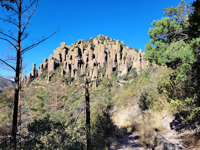
In southeastern Arizona you will find a lonely, isolated canyon full of stunning hoodoos and rock formations. Bonita Canyon, nicknamed a "Wonderland of Rocks," is preserved today as Chiricahua National Monument.
Chiricahua (pronounced "cheer - ee - cow - ah") is a name given to a band of Apache Native Americans who lived in the area for centuries, and is believed to be an Opata word meaning "wild turkey."
Swedish immigrants, Neil and Emma Erickson, settled in Bonita Canyon in 1886. They raised cattle, planted fruit trees and vegetables. In 1903, Neil became a forest ranger. Neil and Emma subsequently left the ranch to their eldest daughter, Lillian. Lillian and her husband, Ed Riggs, continued to operate the ranch, which they dubbed Faraway Ranch. Ed and Lillian promoted the area as a tourist attraction , i.e. a "Wonderland of Rocks," and lobbied the government to protect the area as a national monument. Chiricahua National Monument was established in 1924. The Faraway Ranch House still stands today and can be visited via a guided tour. Neil and Emma Erickson are buried at a cemetary on the property.
There are a number of trails to explore Chiricahua. We combined the Ed Riggs Trail, Big Balanced Rock Trail, Heart of Rocks Loop, Sarah Deming Trail, and the Echo Canyon Trail to do "The Big Loop."
"The Big Loop" is a long hike that will essentially take you through the entire park and see all the highlights. All-in-all it was about 10 miles and took us most of the day. Another option is to park your car at the Visitor Center, take a shuttle bus to the end of the scenic road and then hike back down to the Visitor Center.
We had wonderful weather for our hike as we wound our way through the rock formations.
The rock formations were beautiful. With all of the rock towers, it was as if we were walking through a city of stone.
this collection of hoodoos was very intriguing.
A "hoodoo" is a tall, thin spire of rock formed by erosion.
The trail continued...
this distinct formation is known as Mushroom Rock
the trail now starts to climb to a higher elevation
After the climb, the trail flattens out. Take the short offshoot to Inspiration Point. This point overlooks Rhyolite Canyon and provides a sweeping vista of nearly the entire park.
The view from Inspiration Point
hoodoos towering over Rhyolite Canyon
the prominent peak on the other side of the canyon is Sugarloaf (7,310 ft.)
The trail now continues on the plateau and along additional rock formations.
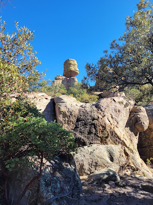
The next big highlight on the trail is Big Balanced Rock.
Big Balanced Rock is a nice place for a snack break. Next, take a short offshoot loop known as Heart of Rocks Loop. The rock formations are plentiful here.
Pinnacle Balanced Rock
"The Old Maid" - the Maid's "face" is facing to the right
the head of "Camel Rock"
Camel Rock
this rock formation looks like ... something ... 😁😉
this pair of rock formations is called "Punch and Judy"
Duck on a Rock. The "duck" is facing away from the camera
After the Heart of Rocks Loop, we headed down to the bottom of Rhyolite Canyon via the Sarah Deming Trail.
At the end of Sarah Deming Trail, head up the Echo Canyon back to the Massai Point parking lot. This was the homestretch of the "Big Loop", and Echo Canyon ended up being the most visually stunning area of the entire hike. The awesome views helped motivate us to finish the hike strong.
narrow trail through Echo Canyon
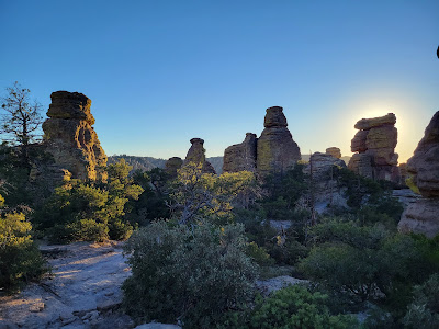
When we reached our car, we got to see a beautiful sunset to conclude our wonderful day at Chiricahua National Monument.
Chiricahua is well-worth a visit. A very cool and unique place.
For more info: https://www.nps.gov/chir/index.htm


No comments:
Post a Comment