Visited: Feb 2015
Nearby town: Panguitch, UT
"[Bryce Canyon] was a hell of a place to lose a cow."
-Ebenezer Bryce
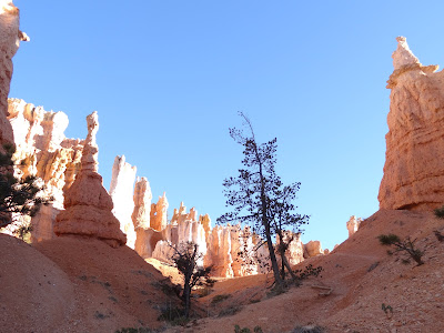
In a windswept, practically empty corner of south-central Utah lies an otherworldly realm of red rock and rock spires. A masterpiece of nature's handiwork, caused by hundreds and thousands years of erosion. Although not a "canyon" (it's technically a horseshoe-shaped bowl, or amphitheater, formed by a number of streams rather than a single one), Bryce Canyon is one of the great natural vistas in the country.
The first whites in the area were Mormon pioneers who settled in the Paria Valley in 1875. Ebenezer Bryce herded sheep and cattle in the area. After a few years of overgrazing, a devastating drought hit the area. The pioneers attempted to divert a river to bring water into the area. The project failed, and most of the settlers left. However, Bryce and his family stayed behind and the area became known as Bryce Canyon.
The highlight of any trip to Bryce Canyon is a hike among the hoodoos. Hoodoos are rock spires, erosion causes the soft sedimentary rock underneath to erode away at a faster rate than the harder rock on top. Just south of Panguitch, head east on Highway 12, on the scenic Red Rocks Highway. After a couple of miles you'll hit Bryce Canyon City. This is a great home base for exploring the National Park. There is the Lodge (and some other hotels), restaurants, horseback rides, helicopter tours and outfitters for exploring the Park.
The main artery for exploring the Park is an 18 mile road that runs north-south through the Park and provides access to 14 scenic overlooks and viewpoints, all on the east side of the road. Your first stop is just past the park entrance: the Bryce Amphitheater region. This is probably the best spot for views of the "canyon" and the trailheads for the best hikes in the park. Here you will find Sunrise Point and Sunset Point. Our first stop was Sunrise Point.
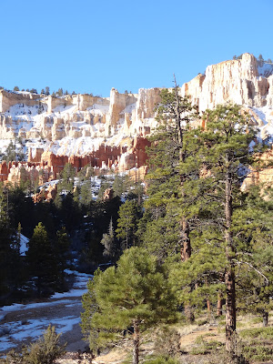
We were so lucky to have amazing weather when we visited. It was an unseasonably warm President's Day weekend, so we decided to drive down and visit. It was cold but not too cold, and we had beautiful big blue skies contrasting with all the snow on the hoodoos. It made for an amazing view.
If there is one hike to do in the Park, make it the Queen's Garden Trail, which starts at Sunrise Point. You can go down and back up the same way, or combine it with the Navajo Trail at Sunset Point to do a 3 mile loop. I would recommend doing the loop trail counter-clockwise, starting at Sunset Point and coming back up to Sunrise Point.
Once you get to the Queen's Garden, you'll see the formation that gives the area it's name. You don't have to use your imagination too much to see the hoodoo that looks like Queen Victoria. It's the formation on the far left.
The trail continues through the Navajo Loop. Once you get back on the rim at Sunset Point you'll see a famous hoodoo known as Thor's Hammer.
 |
| Thor's Hammer is on the far left |
 |
| Natural Bridge viewpoint |
 |
| view at Rainbow Point |
Stop at all 14 overlooks, especially Inspiration Point. It has a spectacular view of the "Silent City." This is a massive grouping of hoodoos. Hundreds of hoodoos (how do you like that alliteration?). It is an amazing sight.
If you want you can hike/backpack the 23 mile (one way) Under the Rim Trail that goes all the way from Bryce Point to Rainbow Point. If you can't hike it, make sure you drive the scenic road. 😊 Bryce Canyon is a great park to visit in one day, but there is plenty to do here for a multiple-day stay. Park entrance fee is $30. Check park website for more info: https://www.nps.gov/brca/index.htm


No comments:
Post a Comment