Sunday, March 25, 2018

Guadalupe Mountains National Park

Visited: March 2017
Nearby town: El Paso, TX; Carlsbad, NM

In an incredibly lonely corner of West Texas, right along the border with New Mexico, rises the beautiful Guadalupe Mountains. Here you will find Texas' highest peak, Guadalupe Mountain, at 8,749 ft. At the base of these mountains is a unforgiving, inhospitable desert, but at the tops exists another world, a more verdant, forested area known as "The Bowl."

We mostly stuck with the desert in this park, but you can climb to the top of Texas with a long, strenuous 8.4 mile round-trip hike with over a 3,000 ft elevation gain. If that seems a tad arduous, there are plenty of other things to do here. If you love the harsh beauty of the desert, Guadalupe Mountains is the place for you.

There are two main areas to explore in the Park: (1) Guadalupe Peak and El Capitan (this is the main section and most visited, this is where Visitor Center is located and trailhead to The Bowl and Guadalupe Peak) and (2) McKittrick Canyon (this is only open during the day, no overnight camping). There is a third area: Dog Canyon, that is very isolated and only accessed by heading south from New Mexico.

We went to McKittrick Canyon first. In the early 1920s, a geologist and oil man, Wallace Pratt, visited this area and fell in love with the place. He purchased most of the land and built a home here that served as his retreat during the hot summer months. Pratt later donated the land to the government that led to creation of the Park in 1972. The McKittrick Canyon Trail is very popular during the fall (to see the changing colors). The entire trail climbs all the way to the Ridge at 7,716 ft and is 7.8 miles. If you want though, it's only 2.4 miles to the Pratt Cabin.

The trail starts out running along a creek bed, the only year-round stream in the Park.


After a few miles, you get to the Cabin.

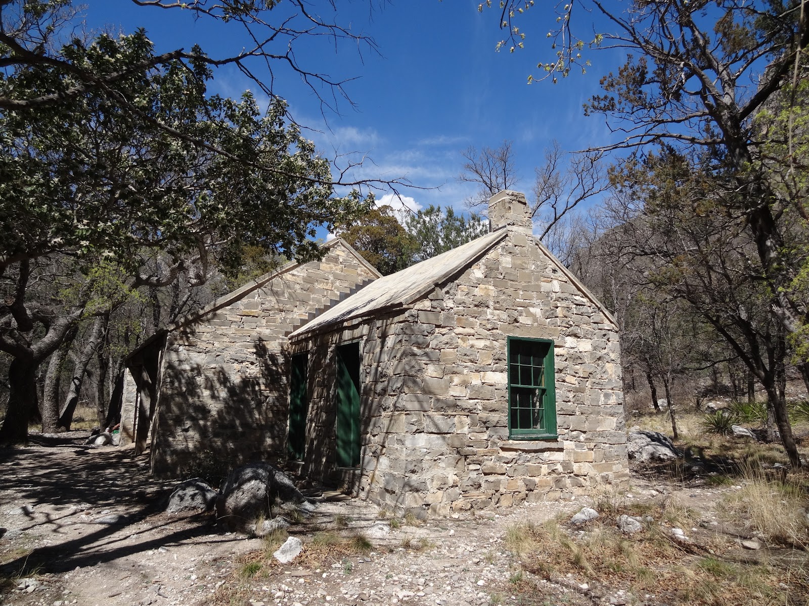
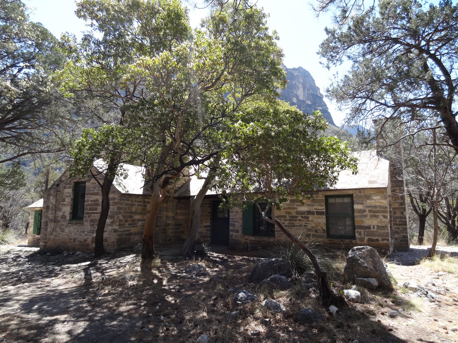


If you want you can return to your car, but do yourself a favor and go about another mile down the trail to see the Grotto. It's a cool little cave. From there you can continue all the way up to the Ridge. But we turned around.


I called this Mike Wazowski Mountain...do you see it?


At the main visitor center, you can see the very prominent El Capitan. At 8,085 ft.

We checked out Frijole Ranch. Built by the Rader Brothers in 1876, this was the first permanent home built in the area. It served as the original visitor center of the National Park. They have a small museum and a small nature hike.


Check out the ruins of the Pinery Station. This served as a stop along the Butterfield Overland Mail Trail. This was a stagecoach service that operated from 1857-1861 offering transport from either St. Louis or Memphis to San Francisco, taking a much more southern route than the Pony Express.


The other trail we took was Devil's Hall. This is a 4.2 mile trail that goes through a dry riverbed to a narrow canyon. It's an ok hike. The destination is pretty cool, but going through all the boulders in the dry riverbed was pretty monotonous and tiring.


notice the small arch on the right


this tree is doing the splits


Don't be afraid of this obstacle. You have to maneuver over these narrow natural stone steps. Going up is a lot easier than going down them.
Just over the steps, you get to the Devil's Hall.


Just got down the steps, I went down on my butt.
As we wrapped up our hike, the sun started to go down. I love evening in the desert.


I love the desert. Make sure to pair your visit here with Carlsbad Caverns National Park in New Mexico. It's only about 30 miles further down the road. Guadalupe Mountains can easily be visited in a day, but you might want to devote two days to do the main region and McKittrick Canyon. Next time we go we'll have to tackle Texas's highest peak. Entrance fee is $5 per person. More info here: https://www.nps.gov/gumo/index.htm

Sunday, March 11, 2018

Jewel Cave National Monument

Visited: June 2013
Nearby town: Custer, SD

In the Black Hills of southwestern South Dakota lie two large cave systems. Wind Cave (which has the designation of National Park) and Jewel Cave National Monument. Why Wind got the Park designation and Jewel Cave never did...who knows? Anyway, Jewel Cave became a national monument by act of Pres. Theodore Roosevelt in 1908. Jewel Cave is the third longest cave in the world, nearly 193 miles has been mapped. 

The cave was discovered by Frank and Albert Michaud in 1900, when they felt cold air rushing out of a hole in the canyon. The hole was much too small for a human to enter, so they enlarged the hole with dynamite, creating the "natural" entrance to the cave. The section the Michauds first entered was filled with calcite crystals, and they named it Jewel Cave.

Before you go down into the cave, you can enjoy some hiking trails on the surface, or just take in the lovely views.


The cave offers four tours. (1) Discovery Talk: this is a very short, easy 20 minute tour. You take the elevator down, explore one cave room, and then back up. (2) Scenic Tour: the most popular, 0.5 mile tour, take elevator both ways and you visit the lowest known section of the cave. (3) Wild Caving Tour: very strenuous tour for spelunkers, and (4) Historic Tour: tour the cave by lantern. 

The Wild Caving Tour and Historic Tour are only offered during the summer. The Discovery Talk and Scenic Tour are only offered on the weekends during the winter, every day in the summer. We took the Scenic Tour, you can buy tickets the day of (as long as you arrive early enough at the Visitor Center, most tours fill up in summer by noon), you can buy tickets in advance up to 90 days.

We did the Scenic Tour. It's a very pleasant hike, not too long, not too many steps. You'll get to see lots of formations, flowstone, calcite crystals, and "cave bacon."


the lowest spot in the cave

some cave bacon
Jewel Cave is a great stop for those visiting Mt. Rushmore/Black Hills region, and is well worth a visit. I'd say if you only have time to visit one cave in the area (between Jewel and Wind) I honestly have to say that Jewel Cave is the better tour. Wind Cave is dry and doesn't have the dramatic cave formations like Jewel does. I've been to Wind Cave years ago before I met Tara (so we haven't checked it off the official completion list yet), so we'll have to return to the region to visit Wind Cave. We would have visited it back in 2013 if we had the goal in place. Oh well, the Black Hills is always a fun time. For more info on Jewel Cave, go here: https://www.nps.gov/jeca/index.htm

Sunday, March 4, 2018

Put a Pin in it!

Tara and I with the most recent update on the Big Map. Tara's pointing to Big Bend. Park No. 36 on our quest to visit all of our national parks.

How do you mark your travels? 

When we visited our first National Park after we got married (Badlands NP), Tara suggested that we get a National Parks "passport" and start getting stamps at places we visit. It sounded lame to me, and it cost money, so it seemed unnecessary and I told Tara no. After visiting a few more Parks, Tara had a great idea. We would get a big map of the United States, and then place a decorative/lapel pin from each National Park we visited. Of course, we could attach the pin to the location of the Park on the map. Ironically (and of course, fitting) this endeavor has been much more expensive than the Passports would have been. 😊 But, I'm glad we did it, the pins are much more cool than the Passport stamps.

It's been kind of frustrating to get these pins. Sometimes, the Visitor Center Gift Shop doesn't have them, or they'll have a pin but it doesn't really look like any of the other pins we have from other Parks. There's no uniform series (which is something I would like). So, I like some pins more than others. But, it has been exciting for Tara and I to collect the pins and put them on our map, hoping to collect all 60 (yes, that's right, there are 60 National Parks now!) on our map.

Here is our newest pin:
 Rio Grande rolling through the canyons of Big Bend.


Love the unique shape of Mammoth Cave pin. It incorporates a stalagmite and a stalactite to take on a very cave-like look. Great Smoky Mountain pin perfectly captures what the smoky blue mountains look like. The Congaree pin shows a very common scene while walking along the boardwalk through the Park.


Acadia pin shows Otter Point.

Pins of the Washington parks: (1) Rainier (2) Olympic and (3) North Cascades

The California Pins (we have so far): Love the Yosemite one

(1) Yosemite (2) Kings Canyon (3) Sequoia and (4) Death Valley


Glacier NP is very unique from the other ones we have.


Our other pins:

Utah parks and Mesa Verde (we didn't get a close up picture of Zion pin once we got it. Oops.

Rocky Mountain Pin highlights Trail Ridge Road


Never been happy with this Crater Lake pin, probably going to get a new one next time we visit.


I must admit, even though I have zoomed in as close as I can. Other than the cabin on the right, I cannot tell what is on this pin! 😊


Arizona's pins are rockin' it! 😊

Our Nation's National Parks...majestic mountains, vast deserts, never-ending forests, magnificent rivers and streams, impossibly colossal canyons and...bathtubs?! 😊
We look forward to collecting all 60 pins. There's also other collectible things and vintage posters of our National Parks that might be subject of a future blog post. One of the joys of traveling is checking things off a list, and I think we have come up a super fun and creative way to check off that list! But yeah, I still regret not getting the goofy National Parks Passport thing. 😊