Monday, February 17, 2020

Theodore Roosevelt National Park - North Unit

Visited: Aug 2018
Nearby town: Watford City, ND

Shortly after Tara and I got married, we visited the South Unit of this National Park. Here is the link to the post of our visit to the South Unit.

The North Unit is about an hour's drive from Medora and the South Unit. It is well worth a visit. The main road runs along the Little Missouri River and then climbs the plateau for spectacular vistas of the surrounding countryside. The closest town to the North Unit is Watford City. Because of its proximity to the Bakken Field, the city is experiencing quite the oil boom. In the 2010 census, Watford City's population was about 1,700. It is now over 7,000 today! The town can't quite keep up with the development. We stayed in a brand new Holiday Inn hotel that looked like a skyscraper, and was obvious built solely for oil field workers. It was a nice hotel, but we had to traverse a muddy, dirt, unpaved, rough road to get to the entrance! 😊

This land was where Theodore Roosevelt ranched and lived the rough life of the Wild West after the death of his first wife and death of his mother (they both tragically passed away on the same day). Theodore Roosevelt's love of the outdoors was greatly enhanced during his time here and led him to champion conservation causes as President. Roosevelt often stated that if it weren't for the time he spent here in North Dakota, he would never have become President.

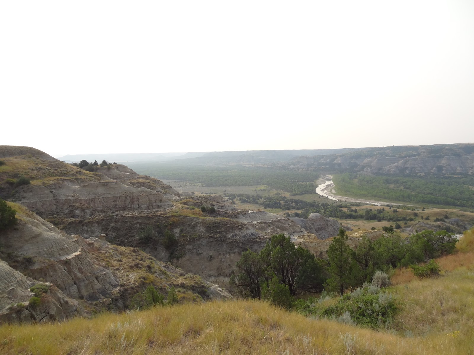
The badlands here are much more dramatic than the South Unit. Enjoy the scenic drive.


The road climbs up the plateau. Make sure to stop at the River Bend Overlook and the Oxbow Overlook. From the Oxbow Overlook (where the scenic road ends), you can hike to Sperati Point. It's a 2.4 mile round trip hike. We didn't have time to hike, but we made sure to stop at the overlooks and take in the views. It was a hazy day (there had been a lot of forest fires in Canada and the smoke had blown down, but the views were still pretty good).


We also stopped at the Cannonball concretions (badlands that have been eroded away to form spherical boulders) and took a small nature trail that took us to the banks of the Little Missouri River.

Cannonball Concretion is an amazing work of nature


Little Missouri River


some big longhorns hanging out by the river


We were also treated to a bison traffic jam! 😁 I love these beautiful majestic creatures.


Tara snapped the picture just a bit too late, but you can see the back end of the bison walking in front of the car in front of us. It was huge! It was practically bigger than the car!


Both the North and South Units of Theodore Roosevelt National Park are well worth a visit. For more info: https://www.nps.gov/thro/index.htm

Monday, February 10, 2020

Natural Bridges National Monument

Visited: May 2017
Nearby town: Blanding, UT


In this small Park located in southeastern Utah, you will find three incredible natural bridges that are all very close to each other. You can see all 3 of these bridges from overlooks by barely venturing out of your car, but you can also hike down to each of these bridges with relative ease.

Unfortunately, we didn't have a whole lot of time to see this Park (we saw many other places on this trip), but this is a cool stop and you can experience just about everything the Monument has to offer in a couple of hours or so.

Natural Bridges National Monument lies a few miles off the main road, Utah Highway 95. Make your first stop at the Visitor Center and then take the Bridge View Drive (it's a one way loop). Your first stop is Sipapu Bridge. You can view it from the road or take the trail down to the bottom of the canyon. It's only 1.4 miles one way, but with a 436 ft elevation change (one way) it's very steep!

We just checked it out from the top.


Sipapu Bridge has a height of 220 ft and a span of 225 ft, making it the 13th largest natural bridge in the entire world.

Further down the road, you can briefly stop at an overlook for the Horsecollar Ruin. This Ancestral Puebloan settlement was abandoned over 700 years ago. You can also take a short hike down to the ruins.

The next bridge is Kachina. Kachina has a height of 210 ft and a span of 204 ft. You can hike down to the Bridge as well, or just view from the road. Like the hike down to Sipapu Bridge, it is 1.4 miles and a steep elevation change. 


Although the terms natural bridge and natural arch are somewhat interchangeable, most geologists agree that a natural bridge is primarily formed by water, while a natural arch is formed by wind or other natural patterns.

A natural bridge is formed through erosion by water flowing in the stream bed of a canyon. The stream will undercut walls of rock (particularly during flash flooding), forming the bridge. At some point, as erosion continues to enlarge the bridge's opening, the bridge collapses under its own weight. There is evidence of at least two collapsed bridges in the Monument. And at some point, all three of these natural bridges will collapse as well.

The last bridge is Owachomo. The hike down to the bridge is only 0.5 miles round trip and a 188 ft elevation change. So, if there is one bridge to get out of the car and explore from some different angles, make it this one. Furthermore, it's kind of difficult to see the bridge from the road (at the time we visited, it really blended with the background). 

Owachomo Bridge is 106 ft tall and has a span of 180 ft. 


Compare with the view at the end of the trail...

The first non-Native Americans to see these bridges were a group of gold prospectors, led by Cass Hite, in 1883. In 1904, National Geographic wrote an article about the area that generated a lot of interest in this region. On April 16, 1908, President Theodore Roosevelt designated the area and established the state of Utah's very first national monument.


We'd love to go back and get up close and personal with the other bridges in this Park. Again, if you hike down to one bridge, the easiest one will be Owachomo at the end of the scenic drive. If you are in the area, be sure to find some time and take a couple of hours to explore this cool Monument. More info here: https://www.nps.gov/nabr/index.htm