Saturday, June 4, 2022

Wrangell-St. Elias National Park

Visited: August 2021
Nearby town: Glennallen, AK

Wrangell-St. Elias is a whopper of a National Park! 😄

Wrangell-St. Elias is, by far, the largest National Park and the largest unit maintained by the NPS. At over 13,175,799 acres, Wrangell-St. Elias is larger than 9 states. The park is larger than Yosemite National Park, Yellowstone National Park, and the country of Switzerland combined! 9 of the 16 highest mountains in the nation are found within the park boundaries. The highest point in the park, Mt. St. Elias - at 18,008 ft - is the second-tallest mountain in the USA. The park also contains the largest piedmont glacier in the world (Malaspina Glacier), the longest tidewater glacier in Alaska (Hubbard Glacier), the longest valley glacier in the world (Nebesna Glacier), and the second largest non-polar icefield in North America (Bagley Icefield). 

It's almost incomprehensible to grasp just how vast and wild this place is. We only saw a small slice of the park...and it was truly incredible. 

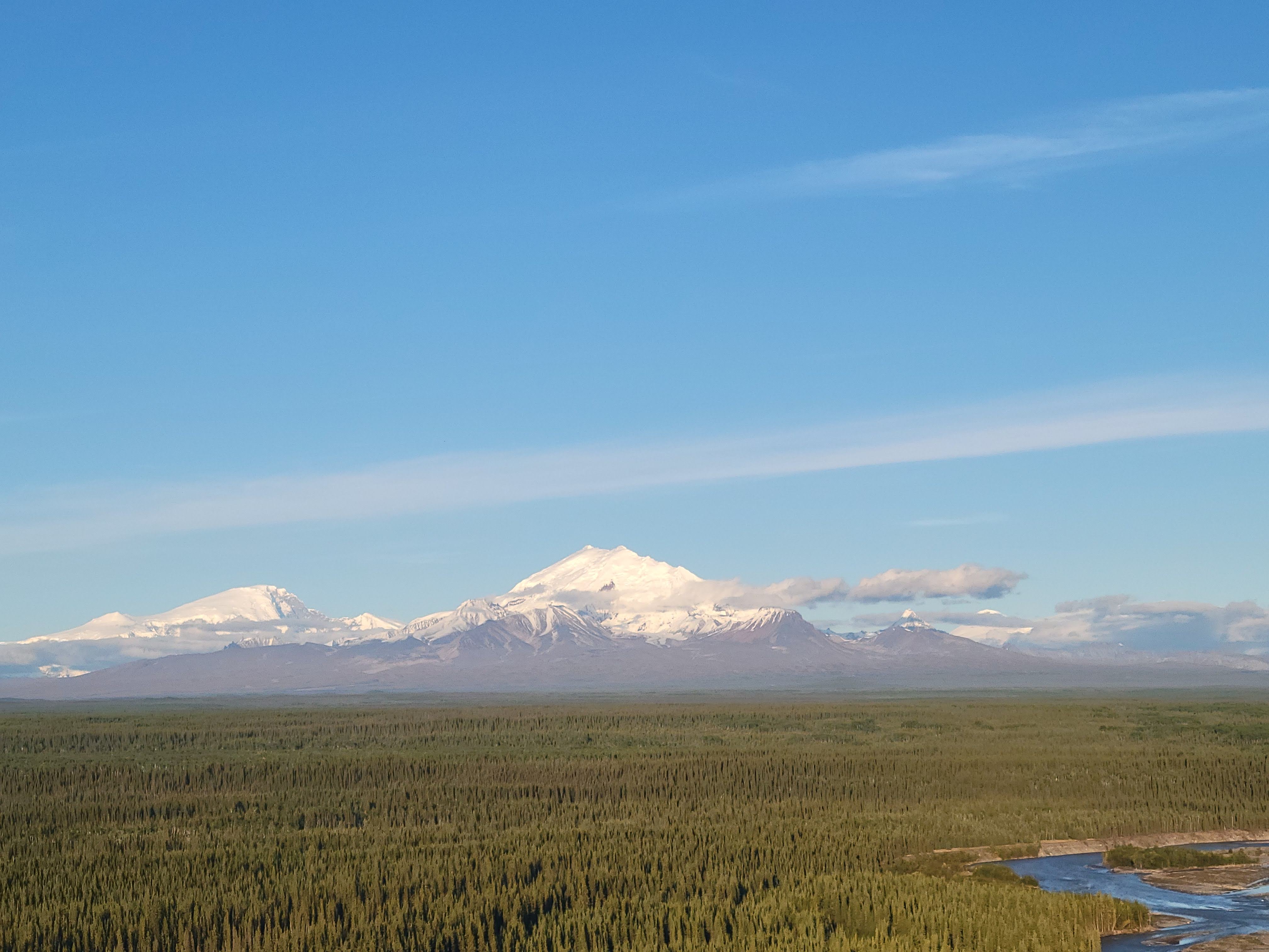
Our adventure began in the small town of Glennallen. Mt. Drum (12,010 ft) lies in the extreme western edge of the park, and towers over the town.



We stayed at a cute bed & breakfast in town - the Antler's Rest. Our first day, we headed to the Visitor Center just south of town. There, we learned about the history of the area and did a short hike that leads to an overlook of the Copper River.


the Copper River runs for 290 miles in south-central Alaska


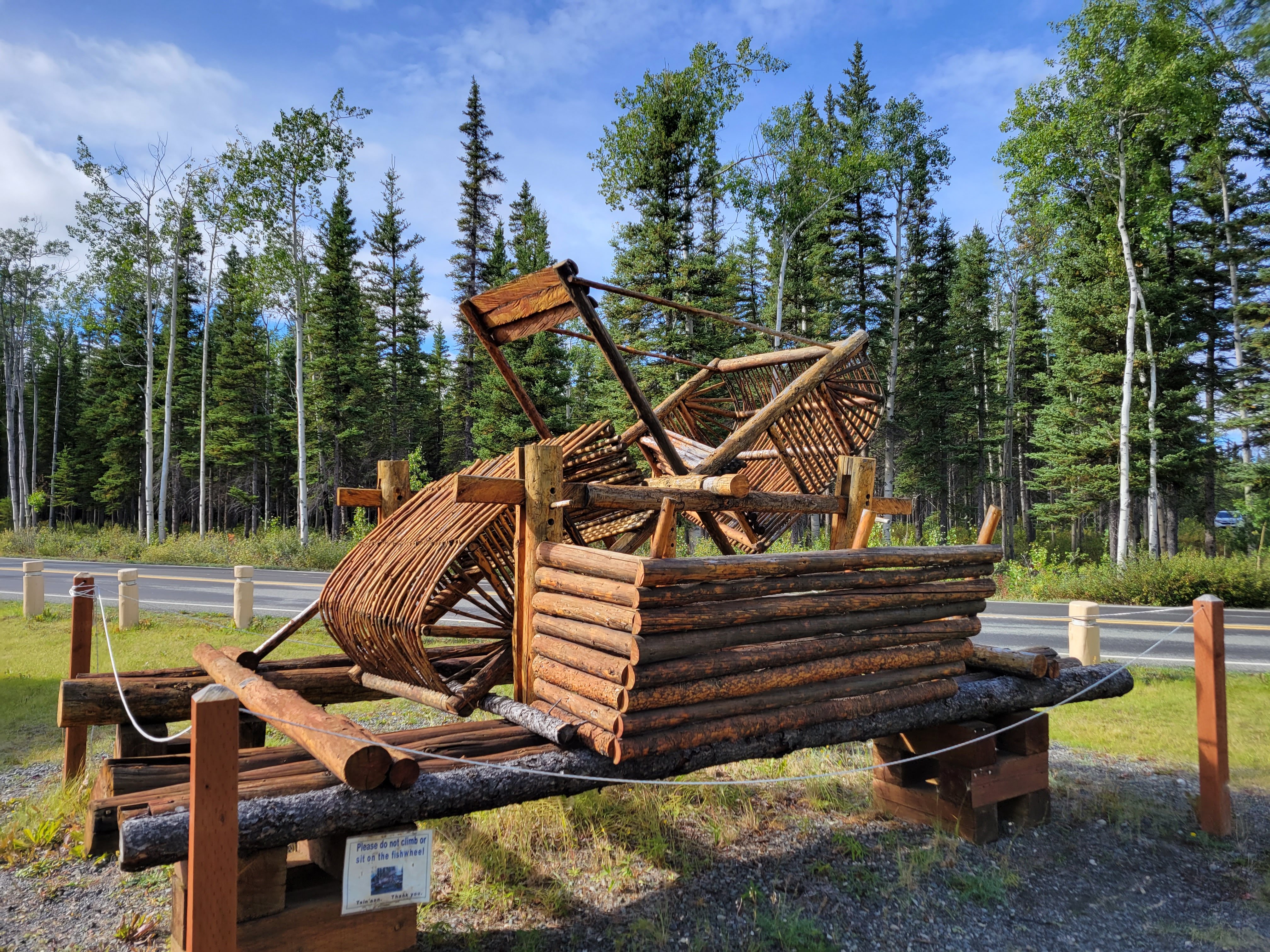
a traditional salmon trap


The next day, we headed into the interior of the park. Deep in the park, you will find the tiny town of McCarthy and the abandoned copper mine of Kennecott. In its heyday, over $200 million in ore was extracted from the mine, making it the richest concentration of copper ore in the world. About 50 people live year-round in the town of McCarthy, but the population explodes in summer thanks to the tourism industry. 

One option to visit McCarthy/Kennecott is to drive the 60-mile gravel road from Chitina to McCarthy (which takes several hours), or to fly in. We opted to fly. We did a day-long guided tour through Wrangell Mountain Air. It was great. It covered the flight in-and-out, lunch, and a hike to the Root Glacier. There was also some down-time to walk through the abandoned mine and ghost town. 

We drove to the Chitina Airport

the "terminal" at Chitina Airpot 😀 

I had never traveled via small plane before...and I was quite nervous about it. But, it was fantastic. I wore a scopolamine patch under my ear to deal with the motion sickness. For the flight out to McCarthy, we took a 6-seater plane.

right before takeoff...yes, I was scared 😁


Seeing the Alaska landscape from this plane was just absolutely incredible. We flew along the volcanic Wrangell Mountain range, over countless glaciers, and into McCarthy. It was a little cloudy in the morning, but we still had great views.
Copper River from the air


Kennicott Glacier

Root Glaicer (later that day, we hiked on this glacier)

as we came in for a landing, we passed by this abandoned mine on top of a mountain


We then hiked through the mining town and up to Root Glacier. When we got to the glacier, we strapped on the krampons (provided to us through Wrangell Mountain Air). It was incredible to walk on a glacier.

All-in-all, it was about a 6 mile hike. We first walked through Kennecott. Almost all the buildings in town are painted with a distinct red color. You'll have time at the end of your guided-tour to explore more of the town before the flight back, but for now, we must bee-line to the glacier.


Kennicott Glacier lies right next to town. The glacier is 27 miles long, and picks up a lot of rocks and soil as it moves along (making it look like a big pile of dirt, but underneath this thin layer of dirt is the ice)

Mt. Blackburn (16,390 ft) poking out through the clouds.

as we head out of town, the trail goes through the forest along the mountainside. It's a pleasant hike. 

If you have more time, you can hike up the mountains to explore some abandoned mines


the toe of Root Glacier (the brilliant white glacier) as it collides into the Kennicott Glacier


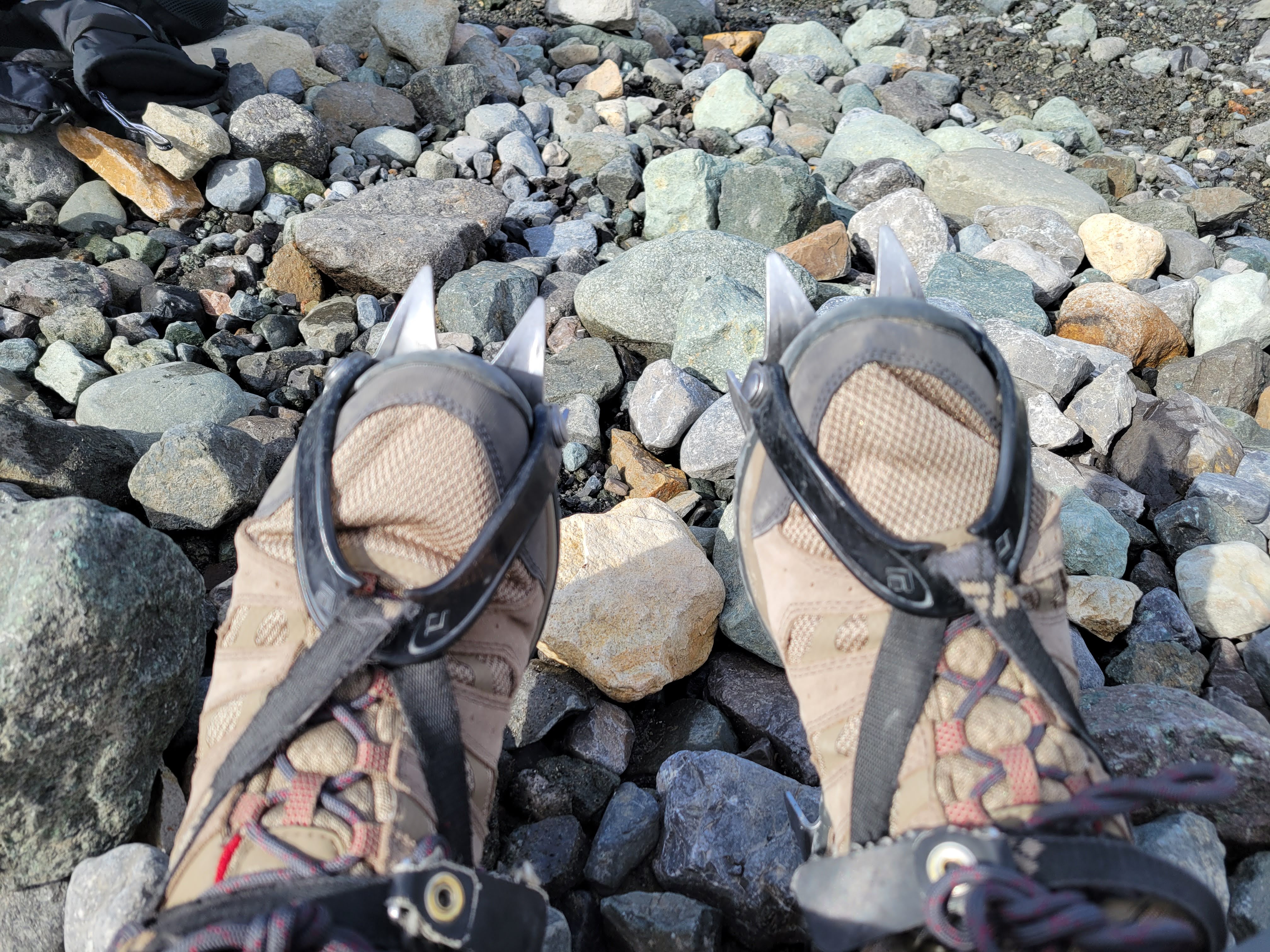
Tara with her krampons on. These help you hike on the glacier safely.


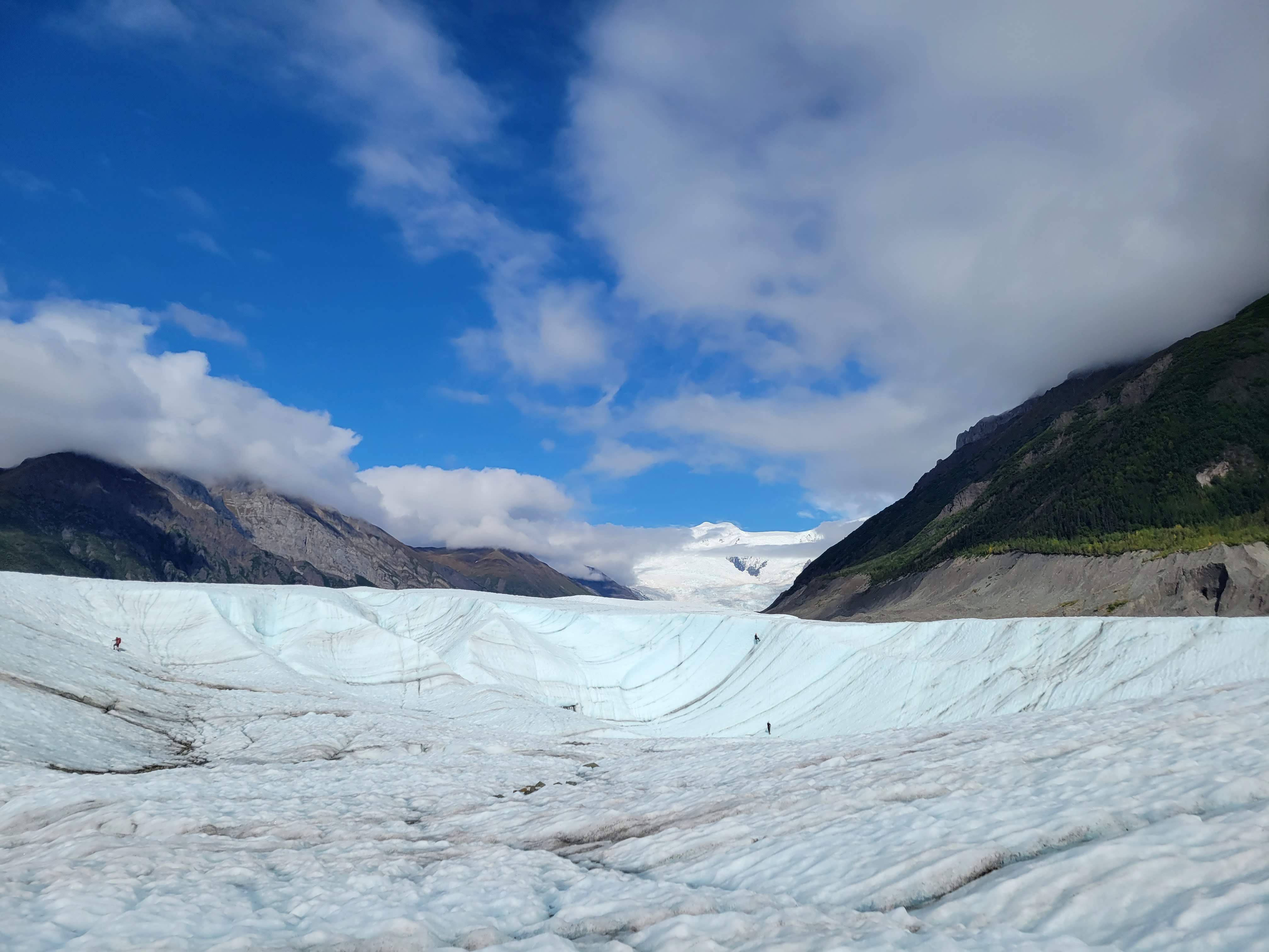


a deep crevice in the glacier, known as a "moulin"

A moulin can be hundreds of meters deep. At the bottom of these crevasses, water runs underneath the glacier, like a river.


in the background is the Stairway Icefall (a 7,000-ft nearly vertical wall of ice). This is the largest icefall in the world outside of the Himalayas. At the bottom of the icefall, the Root Glacier forms.




inside the Kennecott mine buildings


For our flight back to Chitina, we took an even smaller plane. A four-seater, but, there was only three of us on the flight back (me, Tara, and the pilot). Thank goodness there was only 3 of us, because it would have been a tight fit with me in the back. 😂

The clouds broke in the late afternoon, and we had an incredible flight back to Chitina.


this was our trustworthy steed for the flight back.

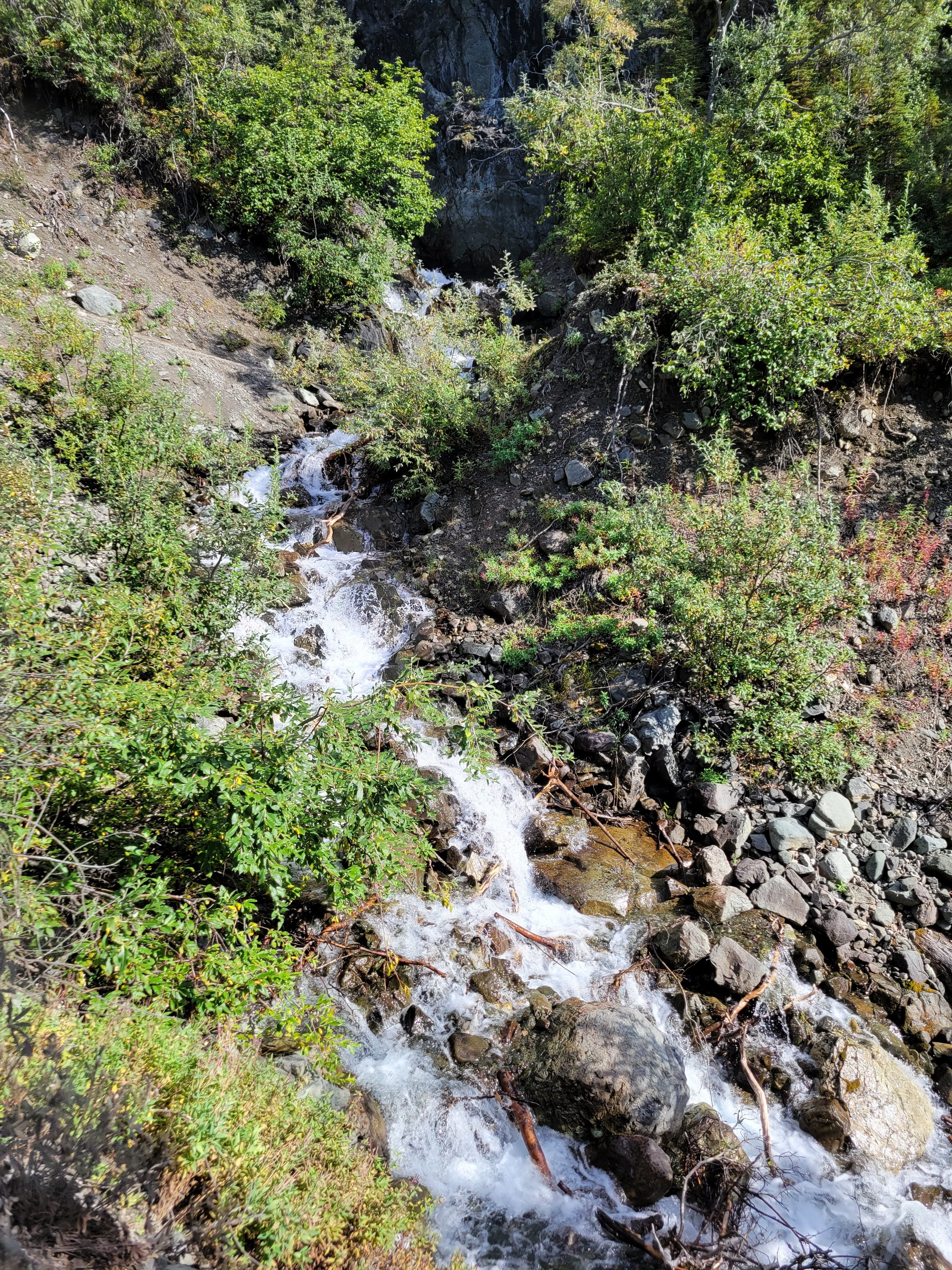
We drove to the small town of Chitina (pop. 100) and took the short hike to Liberty Falls.


The day-trip with Wrangell Mountain Air was one of our most adventure-filled days in our National Parks. We had such an incredible time in this incredible park! For more info: 

Saturday, May 14, 2022

Fallen Timbers Battlefield and Fort Miamis National Historic Site


Visited: Sept 2020
Nearby city: Toledo, OH

The Battle of Fallen Timbers was the final battle of the Northwest Indian War (1786-1795) fought between the US Army and a number of united Native American Tribes (Huron, Iroquois, Shawnee, Delaware, Miami, etc.) known today as the Northwestern Confederacy. The US victory at the battle paved the way to the signing of the Treaty of Greenville and opened up the Northwest Territory to US settlement.

The Northwest Territory was a vast expanse of land covering area north of the Ohio River and east of the Mississippi River (roughly covering the present-day states of Ohio, Indiana, Illinois, Michigan, Wisconsin, and parts of Minnesota). 

After the conclusion of the American Revolution and the Treaty of Paris of 1783, the British ceded this territory to the upstart country. However, the British retained a number of forts in the area (particularly forts near the Great Lakes), and supported the Native American tribes' efforts to prevent American settlement of the area. Many US settlers were eager to stake out land in this wild frontier. This enroachment on long-held Native American land led to a number of conflicts between settlers and the tribes. In 1790, President George Washington and Secretary of War Henry Knox decided to send the US regular Army into the Northwest Territory to subdue the tribes and open up permanent American settlement in the area. Chiefs Blue Jacket and Little Turtle united several tribes to fight against the invading army. The British Empire, still stinging from its defeat to the Americans, was more than happy to help supply and support these tribes with arms. 

The war started out very badly for the US Army. After attempts by Generals Josiah Harmar and Arthur St. Clair were thrawted by the Northwestern Confederacy, Washington appointed General "Mad" Anthony Wayne to lead the US Army. General Wayne had served with distinction during the American Revolution at Valley Forge, the Battle of Stony Point, and the Yorktown campaign. General Wayne combined forces with Charles Scott's Kentucky militia and met a number of tribal warriors on a wooded field near present-day Toledo, Ohio on August 20, 1794. The battle became known as "Fallen Timbers" because a tornado had come through the area a few weeks before the battle and toppled a bunch of trees to the ground. 

Wayne's army successfully routed the Northwestern Confederacy. After the crushing battle, Little Turtle decided it was time to try to cooperate with the Americans and sue for peace. The US victory essentially ended active hostilies in the Northwest Territory. After the winter of 1794-1795, a US delegation (including General Wayne, future-preseident William Henry Harrison, and explorers William Clark and Meriwether Lewis) met with Chiefs Blue Jacket, Little Turtle, and others to hammer out a peace treaty. The Treaty of Greenville was signed in August 1795 (a year after the Battle) and later ratified by the US Senate in December 1795. The Treaty opened up nearly 2/3 of present-day Ohio to American settlement and the tribes recognized American sovereignty over the land. Additionally, the British pulled out of all forts they had in the area and ceded them to American control. In exchange, the US agreed to respect Tribal lands in the rest of the Northwest Territory.

A number of chiefs were distrustful of the Americans, unhappy with the terms of the treaty, and roundly criticized Little Turtle and the other "peace chiefs" who signed the agreement. One of the these tribal leaders was a Shawnee Chief named Tecumseh. Tecumseh refused to sign the agreement. Tecumseh's concerns proved prescient, because by the early 19th century, many US settlers began to encroach on tribal land beyond the treaty line. Unrest ensued, culminating in the Battle of Tippecanoe of 1811 in present-day Indiana. Tecumseh and his followers sided with the British in the War of 1812. But Tecumseh would die for his cause in the Battle of the Thames in Ontario on October 5, 1813. By 1840, nearly all tribal peoples had been expelled from the Northwest Territory and relocated to lands west of the Mississippi River.

Today, the Ohio Historical Society, Toledo MetroParks, and the National Park Service established the Fallen Timbers Battlefield and Fort Miamis National Historic Site and jointly manage the site to perserve its historical significance.

Take the short trail through the wooded grove to learn all about the battle. 


This trip marked Tara's first time in the state of Ohio. She has now been to 46 states! (only 4 more to go: Iowa, Rhode Island, Connecticut, and New York). 😀

On the other side of the road, you can see more of the Park and learn more about the battle. For many years, it was thought that the battle was fought on this plain (based on a journal written by a British mercernary). However, in 1995, archaeological findings confirmed that the battle was actually fought about a mile to the north (where the pictures above were taken).

this spot marks where Turkey Foot, an Ottawa Chief, was mortally wounded during the battle.


Statue depicting General "Mad" Anthony Wayne flanked by a Native American scout and a frontiersman


The site also includes the ruins of Fort Miami. We did not have time to explore that area of the NPS unit. 

If in the area, it's worth a short stop to walk the grounds and learn about the battle.