Visited: Sept 2014
Nearby city: Kalispell, MT (West Entrance), St. Mary, MT (East Entrance)
"Far away in northwestern Montana, hidden from view by clustering mountain peaks, lies an unmapped corner - the Crown of the Continent"
-George B. Grinnell (1901)
Tucked away in the corner of northwestern Montana lies a natural wonderland of beautiful mountains, pristine lakes, deep and endless forests, waterfalls, and of course glaciers. Glacier shares a boundary with Waterton Lakes National Park in Canada, the two parks have been combined to form an International Park that is the only one of its kind in the world.
Unfortunately the unique and eponymous feature of the Park, the glaciers, are quickly disappearing. In the mid 19th century there were over 150 glaciers in the park. Due to rising global temperatures and climate change, only 25 glaciers remained in 2010. If these weather patterns continue, experts predict that all the glaciers in the Park could be gone as soon as 2030. So if you want to see some glaciers, you better head to Montana soon. But not too soon, there is a terrible wildfire that is ravaging the Park, particularly the western portion. Tragically, one of the historic chalets in the wilderness area, Sperry Chalet, has burnt down. Hopefully the Park will recover soon.
There are four main entrances/regions to the park. Entrance fee is $30. On the western side is (1) Apgar Entrance and Lake McDonald. On the eastern side is (2) St Mary Lake, (3) Two Medicine Lake and (4) Many Glacier, home base for a number of hikes to Grinnell Glacier and the other Chalet that is only accessible by foot, the Park Chalet. Apgar/Lake McDonald and St. Mary Lake is connected by the Going to the Sun Road (the only road within the park that connects the western and eastern half). No trip to Glacier is complete without driving on this impressive, incredible road built in 1932. Near the halfway point of the Going to the Sun Road is the Logan Pass Visitor Center. There is also a backcountry area known as Goat Haunt that can only be accessed by hiking trail or boat from Waterton Park in Canada. Waterton is worth a visit, but make sure you bring your passport if you plan to visit.
Our trip to Glacier started on the western side of the Park, along the shores of Lake McDonald. We parked at the Trail of the Cedars Nature Trail. You can take this very short hike to see Avalanche Falls, or you can take the 2 miles hike to Avalanche Lake. This is probably the best short hike in the park. Avalanche Falls was very low this year (especially this late in the year in September) and is the first sight visible right away on the hike. Then, the hike follows the Avalanche Creek and makes for a pleasant stroll.
 |
| the Falls |
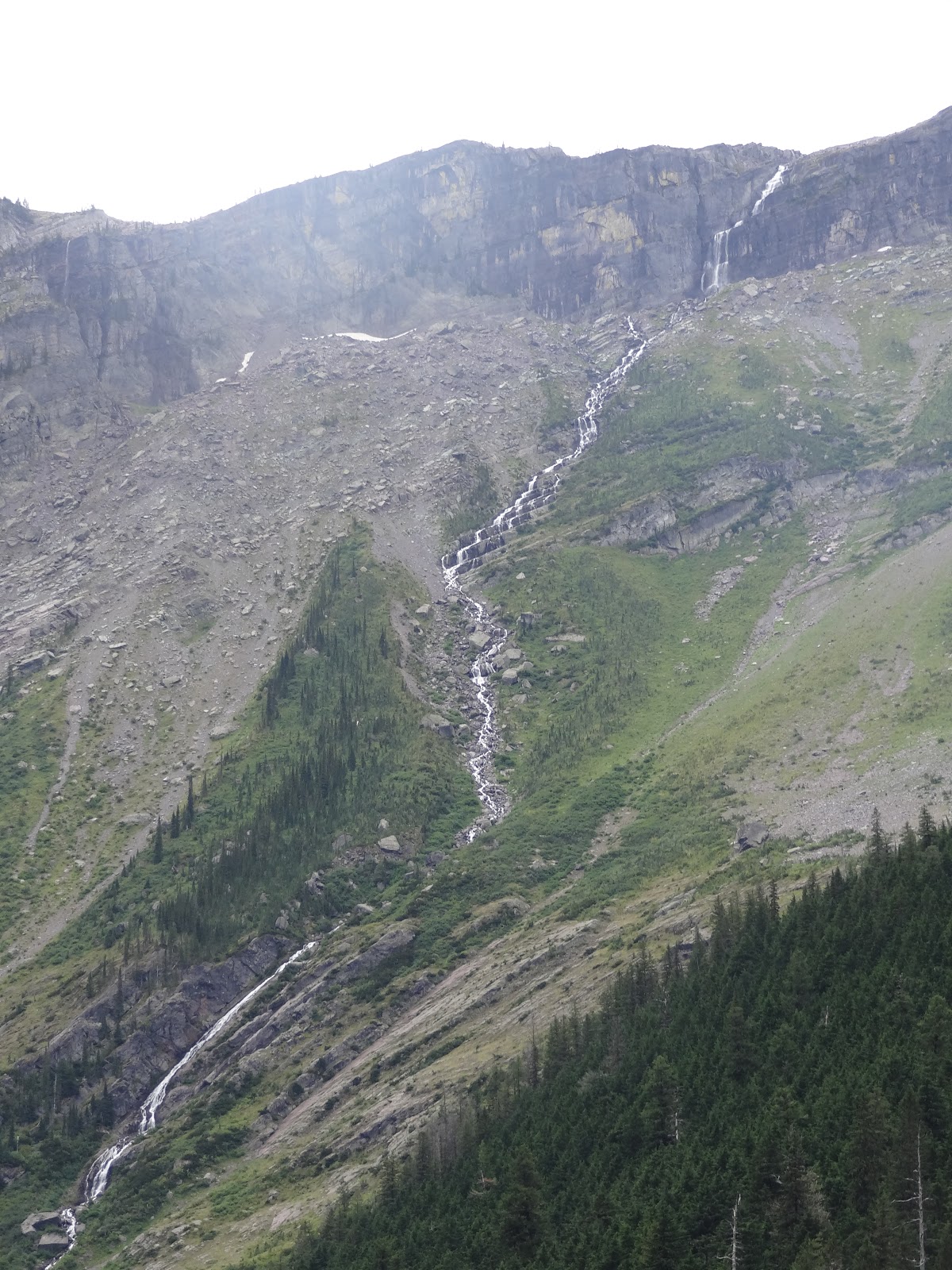
After meandering along the river through the thick forest, it opens up to an amazing view of Avalanche Lake and the surrounding mountains. It was amazing to see all the waterfalls (water from Sperry Glacier) feeding into the lake.
After we had our fill at Avalanche Lake, it was time for some white knuckle driving on the Going to the Sun Road. I've driven alot, all over the West, and on lots of mountain roads. I got to tell you, Going to the Sun Road will test your nerves. It's safe, but I would be scared to drive the road in bad weather. The views were amazing, we didn't take too many stops along the road, but the pictures just don't capture the true majesty of these mountains. This is a place you must see for yourself.


We stopped at Logan Pass Visitor Center. It's a popular place and the lot fills up around 11:00 in the morning. But we were lucky and were able to find a spot. From the Visitor Center you can take the hike to Hidden Lake. It's a 1.5 mile hike to the overlook, or 3.5 miles to the lakeshore. We decided to just hike to the overlook. The trail is a nice boardwalk and we were about halfway there when the weather changed dramatically. A storm rolled in very quickly. Unfortunately, there was nowhere to take cover, no trees, we were very exposed along that trail. Although we continued on the trail bravely, once the rain turned to hail, we had to turn back. We got very wet, the wind was brutal, and of course, as soon as we got back to the Visitor Center the storm had vanished as quickly as it had appeared.
 |
| I really did not want Tara to take this picture 😊 |
The eastern half of the Going to the Sun Road runs along St. Mary Lake and then we headed north to see Waterton in Canada.
 |
| Prince of Wales Hotel at Waterton Lakes National Park |
Our next day at the Park we went to Two Medicine region. We took a ferry across Two Medicine Lake and then hiked about a mile to Twin Falls. If you have more time you can hike to Upper Medicine Lake or if you have a lot more time you can backpack up to Triple Divide Peak. From this unique spot, depending on where the rainfall lands on the mountain, the water can flow west to the Pacific, east to the Atlantic, or north to the Arctic Ocean. It was a great boat ride and hike.
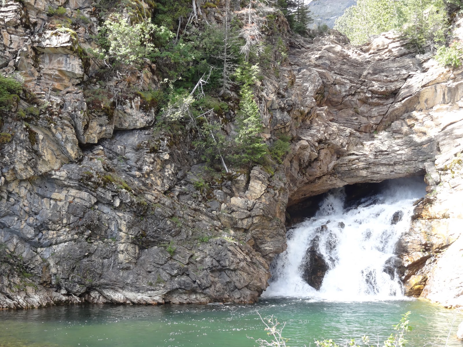
We then took a short hike to Running Eagle Falls, also known as Trick Falls.
Glacier is a great park and we can't wait to go back and visit more. On our next trip I believe we will spend most of our time at the Many Glacier region. We also would love to hike and stay the night in one of the Chalets, hopefully they will be able to rebuild the Sperry Chalet. For more info go to: https://www.nps.gov/glac/index.htm