
Arches National Park in south-eastern Utah is one of my favorite National Parks in the country. We decided to take a long weekend and revisit for my birthday in May 2019.
The blog post for our first trip to Arches can be seen here: https://paulnationalparks.blogspot.com/2017/08/arches-national-park_14.html
On our first trip, we hiked the Delicate Arch Trail (which leads to the famous landmark), but we we’re short on time so we did just a small portion of the Devil’s Garden Trail (about a mile to the first major landmark - Landscape Arch). We’d been itching to explore more of this area on a subsequent visit.
On our second visit to the Park, Tara and I tackled the Devil’s Garden Trail. This trail is over 7 miles long (if you do the full loop and all spurs off the main trail) and passes by several arches: Landscape Arch, Navajo Arch, Partition Arch, Double O Arch, and Dark Angel (this is not an arch but a towering rock column). You can also see Private Arch from an overlook along the main trail, and get closer to it by taking the north-portion of the loop trail (which is much more undeveloped and primitive than the main trail). We decided to do an out-and-back to Double O Arch (from there, you can see Dark Angel, but we didn’t hike all the way to the base of that tower).
The trail starts out relatively flat and easy, and after about a mile you come to Landscape Arch. This is the longest arch (in terms of span) in the entire park. Most people will at least hike to this point because it is relatively short and easy to get to this spot. If you are short on time, I would recommend taking the Devil’s Garden Trail to at least this first major landmark.


After Landscape Arch, the trail becomes much more difficult - but it’s not too bad. You start to climb up an exposed fin. It’s quite steep, and the rock can be slick so make sure you have sturdy shoes with good traction. At the top, take the spur off-shoot to the left to hit Partition Arch and Navajo Arch.
Navajo Arch is secluded and quite beautiful.


Once you’ve taken in the views, head back to the main trail and continue north (to the left). At this point, the trail gets quite a bit undeveloped, use the rock cairns to guide your way. You’ll start to see a maze of sandstone fins off to your right.

You’ll start to climb some of these fins yourself...but nothing near as precarious as the ones pictured above. There’s nothing too crazy here, but be prepared for a little bit of a climb. If it’s rainy, it’d probably be wise not to do this hike, the sandstone can become rather slick. Thankfully, we had great weather, and the hike is very adventurous and fun.


Now, you can also head back to the trailhead by way of the primitive portion of the Devil’s Garden Trail (thus making a loop back to the parking lot). Bear in mind, that this portion of the trail is very sandy, does not have an established path, and is quite precarious and has some steep climbs over sandstone fins. We decided to just head back the way we came. There is one arch along this primitive portion (Private Arch) - but it can be seen from an overlook along the main trail.
Devil’s Garden is a great hike - we thoroughly enjoyed it.
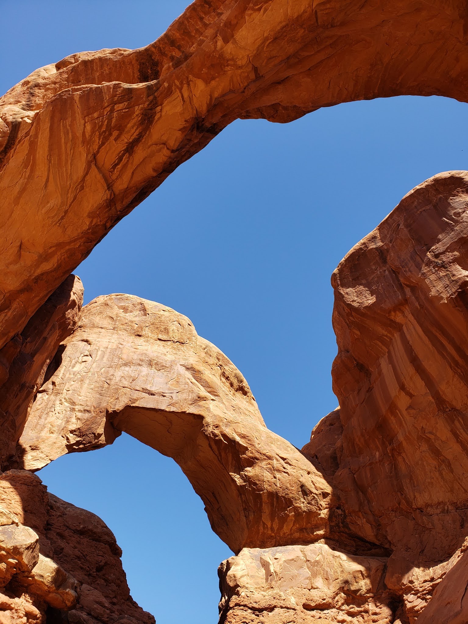
We also visited other parts of Arches - The Windows Area: this consists of North and South Window, Turret Arch, and my favorite, Double Arch. Also stopped by Balanced Rock along the main road and Park Avenue near the park entrance.


We love Arches and can’t wait to go back! Next time we go, we want to do the Fiery Furnace Trail (this is only available with a permit or through a guided tour offered by the Park - you have to reserve quite a bit in advance because it fills up quickly).
BONUS: we went over to Dead Horse Point State Park to check out some fantastic views of the Colorado River and the dramatic surroundings. This State Park is near the Island in the Sky region of Canyonlands National Park.


