
Visited: Feb 2015, Nov 2017
Nearby town: Torrey, UT
"What makes the desert so beautiful is that somewhere it hides a well."
-Antoine de Saint-Exupery, writer and pioneer aviator
Most tourists heading to this part of the country spend time in Zion, the Grand Canyon, Bryce Canyon, or Arches. Capitol Reef, although only half a day's drive from all of these fantastic national parks, kind of gets overshadowed and forgotten. In fact, when Tara informed her co-workers that she was headed there for the long weekend, most of them shrugged their shoulders, they had never heard of the place. And I think it prefers it that way. 😊 Captiol Reef is indeed "Utah's Best Kept Secret."
Capitol Reef is remote. It's smack dab in the center of a rather empty circle (on a map at least) in central Utah. The nearest traffic light is over 78 miles away. The night skies are incredibly dark and full of stars and the Milky Way. The hikes are a rather lonely affair. If you want to feel like the only person left on earth, Capitol Reef is the place to go.
Capitol Reef National Park is long and narrow, it protects the nearly 100-mile long upthrust formation called the Waterpocket Fold. The Waterpocket Fold is a warp in the Earth's crust over 65 million years old, likely caused by the collision of continental plates that created the Rocky Mountains. It is the largest exposed monocline in North America. "Capitol Reef" refers to the particularly dramatic part of the monocline along the Fremont River. It is called a "reef" as it is a rocky barrier and obstruction to land travel, just as an ocean reef is a barrier to sea travel. Although the views are impressive from the ground, the fold in the earth's crust is incredibly prominent when viewed from the air.

This area was long the home of Fremont Peoples, then the Ancestral Pueblans, and also the Paiute and Ute Indians. As with most of Utah, the first white settlers were Mormon Pioneers, who established the town of Fruita along the Fremont River in the late 19th century. Fruita prospered but was never home to more than 10 families or so. Bishop Ephraim Pectol and his brother-in-law, Wayne County High School principal Joseph Hickman started to promote the scenic beauty of the area in the 1920s. Pectol was later elected to the State Legislature and was able to convince FDR and the federal government to designate the area he called "Wayne Wonderland" (after the county it was located in) as a National Monument in 1937. Visitation was extremely limited until Utah Highway 24 was constructed through the park boundaries along the Fremont River in 1962. Capitol Reef became a National Park in 1971.
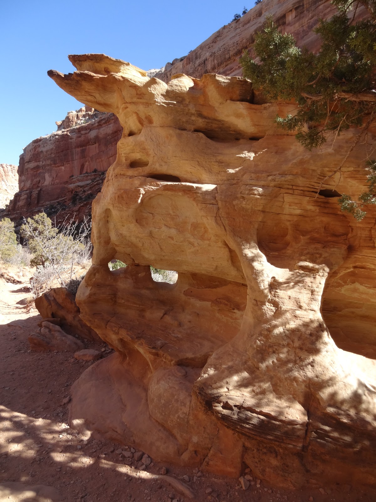
Our first visit to the Park back in 2015 was a very quick drive through. We had gone to Bryce Canyon for a long weekend and on our way back to Idaho we took Scenic Highway 12 to Torrey. We then made some stops along Highway 24 in the Park, went to the Visitor Center, the old town of Fruita, and drove the Scenic Highway. We weren't able to do any hiking, and we only spent maybe a grand total of 1.5-2 hours in the park. Our most recent visit (last week) we devoted an entire 2 days to the park. It was beautiful and I really appreciate this park. It's got a little bit of everything that you find in the other national parks of Utah, with a lot less people. There are natural bridges, arches, narrow canyons, dramatic mountains and domes, interesting and otherworldly rock formations, beautiful night skies, and miles and miles of scenic hiking.
Approaching the Park from the West along Highway 24 your first stop will be the Chimney Rock overlook. You can take a 3.5 mile hike to climb the mesa near Chimney Rock, but the views from the road are very good as well.


Your next stop along the highway is Panorama Point. Get out of the car to stretch your legs and soak up the views. You'll want to return her later in the evening for a short drive on an unpaved road and then a short hike to Sunset Point.
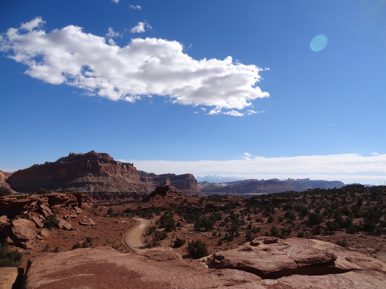

Right before you get to the Visitor Center, you'll see a brilliant formation on the north side of the road called "The Castle."


Make sure to stop at the Visitor Center to learn about the geology and the early life of the pioneers of Fruita. Have a picnic in the orchards, from June to October you can even pick fruit for a small charge. Stop at the Gifford Farm House for dessert, check out the Historic Fruita School and take the short walk to the Petroglyphs on the cliff face.
 |
| Gifford Farm House |


 |
| petroglyphs |

 |
| one-room Fruita Schoolhouse |
 |
| the trail starts along the Fremont River, but you will start climbing up to the mesa right away |

 |
| Capitol Dome |


 |
| Pectols Pyramid |


Eventually you'll get to the Hickman Bridge overlook.
 |
| kind of camouflaged, but it's there. Center of the picture |


The trail to Rim Overlook continues to climb and climb along the ridge. The views are impressive.


 |
| the up-thrust is very evident as you climb higher and higher. Or maybe Tara just isn't holding the camera steady 😊 |


 |
| it's a long way down |
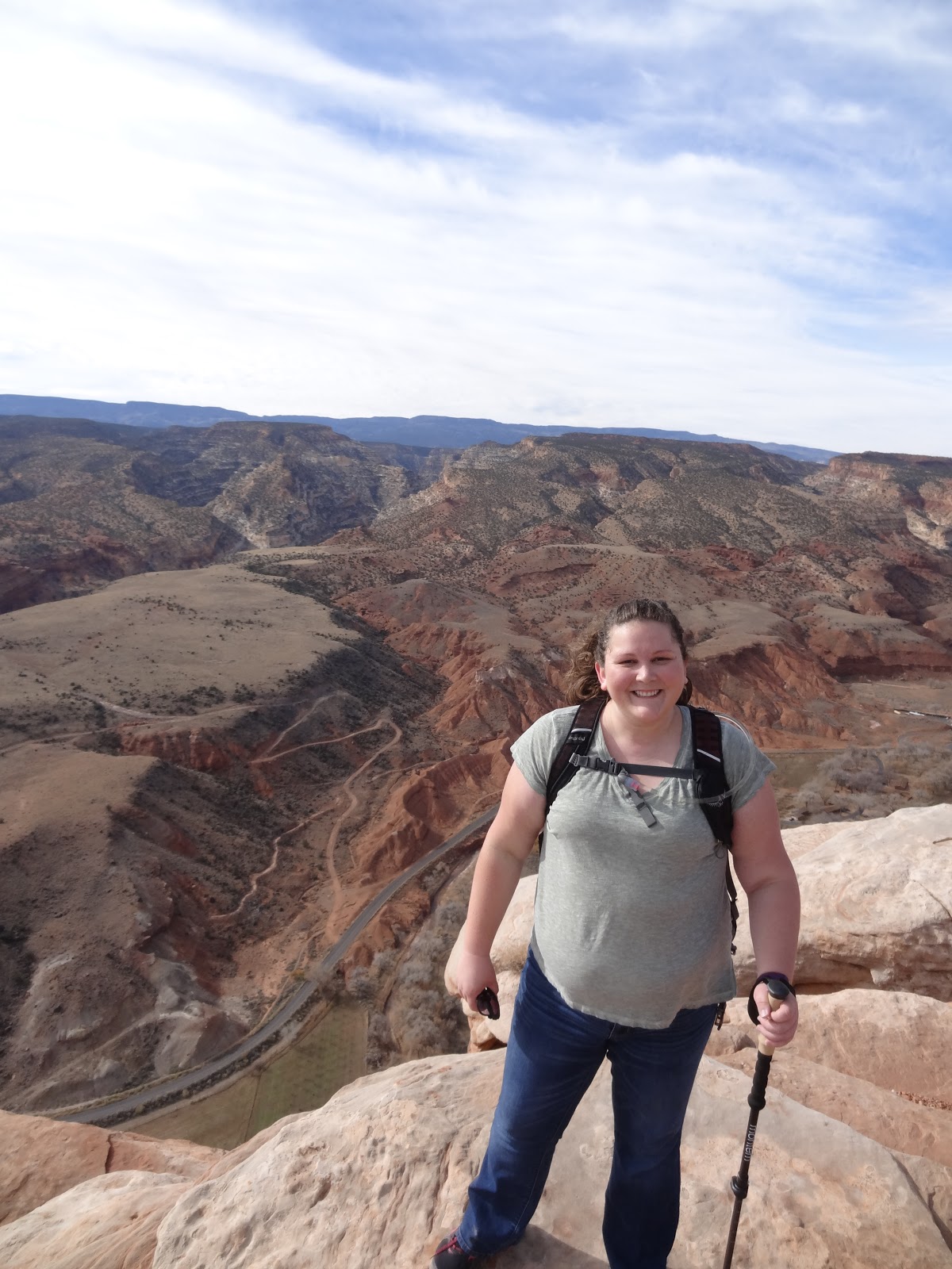 |
| at the Rim Overlook |


 |
| Capitol Dome |
Next we head down the 10 mile Scenic Drive, there's lots of pullouts along the drive. My favorite formation is the one known as the "Egyptian Temple."


About halfway down the Scenic Drive, take the dirt road to the parking lot for the Grand Wash hike. This is a nice easy hike. If you go the full way it's 4.5 miles round trip, but you can turn around once you get to the Narrows after 1.5 miles or so.


If you want you can take a 1.5 mile spur trail off of Grand Wash to climb up to the mesa to see Cassidy Arch. Named after Butch Cassidy himself. You can also see the Arch from the road.
 |
| zoomed in photo of Cassidy Arch |

 |
| view of Cassidy Arch from the road. It's top-center of the photo. |


At the end of the Scenic Drive, the road becomes unpaved, follow it a few miles to a parking lot to hike Capitol Gorge and the Golden Throne.


 |
| Register Rock |

The highlight of the park was spending the evening at Sunset Point. Head back to Panorama Point near the western park entrance. You'll drive on a dirt road for about a mile and then it's a half a mile hike to Sunset Point. Now, you're not watching the sun, you want to face eastward for the spectacle is seeing the shadows of the sinking sun on the cliff faces of the Capitol Reef. The rock wall becomes a canvas to the majestic artistry of the sun. It was wonderful.

 |
| love the shadow of The Castle |


There's much more to the park, but you'll have to access the backcountry to get to it. I hear that Cathedral Valley in the extreme northern end of the park is worth visiting, but you need to have a 4WD high clearance vehicle or go on a Jeep Tour (there are lots of tours offered in the town of Torrey). Or you can visit the southern regions of the park along the Burr Trail Road. It's unpaved and long, but I don't believe high clearance vehicle is required. If you've been to southern Utah a number of times and you're looking for a place that doesn't get too many tourists or you've already been to Moab or Zion lots of times, consider a visit to Capitol Reef. The Scenic Drive is the only part of the park that has an entrance fee, it's $10 per vehicle. More info at: https://www.nps.gov/care/index.htm
This park is very beautiful. Where does it rank in your Utah Parks? Looks like it is a "secret" because no one else was there but the two of you. It has an end of the earth look to it.
ReplyDeleteUtah is a National Park paradise, so although Capitol Reef is super cool I would still only rank it fourth, behind Zion, Arches, and Bryce Canyon.
Delete